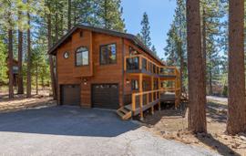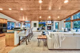
Life in Lake Tahoe with a bit of real estate news
Shirley Lake Trail starts off Squaw Peak Road in Squaw Valley.

One of Squaw Valley's best hike. It's approximately four and a half miles to the lake and back. Some people choose to hike up to High Camp and take the cable car down.
Granite Chief Trail is located in Squaw Valley.

It is approximately 11 miles up and back. There are great views of Squaw Valley and once at the top there are great views of Lake Tahoe. The trail wanders through cliff bands and creeks and gains approximately 2850 feet. This is a pretty difficult trail and takes anywhere from 5 to ...
The Western States Trail starts at Squaw Valley and ends in Auburn.

To the east is a fun trail starting at Hwy 89 where the bridge crosses the Truckee River with a challenging but fun climb to start consisting of many switchbacks. It climbs to "The Wall" then over to many trails near Mt Watson and Lake Watson.
...Pole Creek Road is located off of Hwy 89 and north of Squaw Valley where Pole Creek meets the Truckee River. This is considered an intermediate to advanced ski tour. You can either go out and back or ski / hike over to Squaw Valley and Sugar Bowl.

The Nature Loop is located near the Northwoods Clubhouse in Tahoe Donner.

There is plenty of parking most every day and the trail leaves from the north side of the parking lot. It is approximately 1.8 miles long and is rated relatively easy on foot but challenging on a bike. It is possible t...
Alder Creek Trail is located on the North side of Tahoe Donner off of Alder Creek Road. The trail follows Alder Creek NE toward the campground.

It is approximately 1.9 miles long and is an easy hike. Biking can be a bit more of a challange. Occasionally during the afternoon you can see beavers swimming in the creek.
This trail is just south of the South Lodge at Homewood Mountain Resort. Turn on Meadow off of Hwy 89 until it turns right onto Lagoon.
This is a fun little trail to walk the dog or go for a run. There is a loop in the back or you can get up to Quail Lake and over to Homewood. They held the biathlon and cross country events here during the 1960 Winter Olympics.
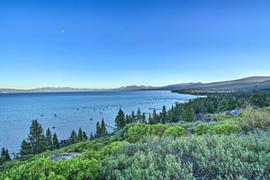
Located on the west shore of Lake Tahoe, this is a nice trail that climbs into the woods or you can get into Sugar Pine Point State Park and over to General Creek. There are a few points where you get neat views of Lake Tahoe. Fun for walking or running with the dog and mountain biking as well as snowshoeing.

Located on the west shore of Lake Tahoe in Tahoma, many miles of trails can be accessed from both ends of Antelope.
On the northern end there is a green gate and the southern end the trail begins at the cul-du-sac. These trails either lead to General Creek in Sugar Pine Point State Par...
This is a great little trail. It is at the very end of Lewis Ave and there is a small area to park off the street. Please respect the locals. This connects to all the trails behind Westlake Village, McKinney Estates and Sugar Pine State Park including General Creek.